Jodi Bieber – Bitter Berry Day Break
Bitter Berry Day Break by Jodi Bieber reflects on moments of quiet transition and the subtle narratives that unfold within everyday life. The photographs draw attention to atmosphere, gesture and place, revealing a sensitive observation of people and environments within South Africa.
Noord-Kaap / Kapa Bokone / The Northern Cape
Noord-Kaap / Kapa Bokone / The Northern Cape is a long-term photographic project by Jodi Bieber that reflects on life in one of South Africa’s most remote and sparsely populated regions. The work began in 1997 and 1998 when Bieber spent three months travelling through towns such as Pofadder, Nababeep, Eksteenfontein, Port Nolloth, Riemvasmaak and Pella with the support of a small grant from the National Arts Council.
Working exclusively in black and white during this initial journey, Bieber documented communities whose stories were rarely visible beyond the region itself. Her photographs included portraits of the Bosluis Basters of Eksteenfontein, a community forced to relocate there during apartheid, the independent diamond divers working off the coast of Port Nolloth and families returning to Riemvasmaak after a successful land claim restored their ancestral land.
More than two decades after the end of apartheid in 1994, Bieber has returned to the Northern Cape to revisit these places and reflect on how the communities she first photographed have evolved over time.
A Vast and Isolated Landscape
The Northern Cape covers nearly thirty percent of South Africa’s landmass yet remains one of the least populated regions in the country. In 1994 the province held roughly 840,000 people, just over two percent of the national population.
With an average of little more than two people per square kilometre, many settlements remain geographically isolated and socially overlooked. Two thirds of residents speak Afrikaans as a first language, and more than half of the population is classified as “Coloured,” demographic realities that have shaped the region’s cultural identity and historical experience.
Returning to the Archive
Bieber’s project raises an important question: how have political transformation, economic shifts and technological change reshaped the everyday lives of people living in these remote towns?
The photographs produced during the late 1990s now form part of an important visual archive. Such archives are not only historical documents but also tools for understanding the present. They preserve stories that might otherwise remain unseen while allowing communities to reflect on their own histories.
“Visual archives reveal the slow transformations of place, allowing past and present to speak to one another.”
Pofadder Revisited
In 2015 Bieber returned to Pofadder for a two-week period to document the town and its surrounding township. During this visit she photographed both the landscape and the people living there, revisiting familiar locations while observing new developments that had emerged since her first visit.
Among the most visible changes was the construction of a large solar farm promising economic development and employment opportunities. At the same time residents expressed concerns about the long-term sustainability of these projects. Spanish contractors who had worked in the region since the late 1990s often departed once contracts were completed, leaving questions about local job creation.
Shifting Social Realities
The return to Pofadder also revealed ongoing social challenges. Community members spoke about the increasing presence of drug addiction alongside the long-standing problem of alcohol abuse. Concerns were raised about tensions directed toward Ethiopian shopkeepers and about the gradual movement of younger white families toward nearby farms or larger cities where education opportunities for their children were perceived to be better.
The township itself remained sparse and dry, with limited signs of infrastructure development beyond some examples of RDP housing.
Looking Forward
Bieber’s continuing engagement with the Northern Cape suggests that these communities remain in a state of gradual transition. If social development initiatives connected to the solar farm succeed and new employment opportunities emerge, towns such as Pofadder could look very different within the next decade.
For her planned monograph, Bieber intends to combine her original black and white archive with newly produced colour photographs. This dialogue between past and present will offer a layered portrait of the Northern Cape, revealing how landscapes and communities change while still carrying traces of their earlier histories.

Jodi’s work brings together portraiture, landscape and quiet everyday scenes, revealing moments where memory, place and the present quietly intersect.


Bosluis Basters — Eksteenfontein
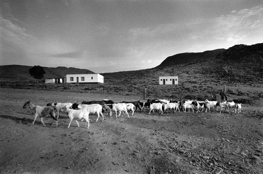
In the Richtersveld, a semi-arid desert region in the Northern Cape, a small community of roughly 500 to 800 people relies primarily on goat farming alongside employment in nearby mines. When Jodi Bieber first arrived, the town consisted of two small shops, a community centre, a guesthouse, a petrol pump, a bottle store and a handful of churches. Electricity had not yet fully reached the settlement and generators still supplied power while electricity lines were in the process of being installed.
The story of Eksteenfontein’s church reflects the resilience of the community in the face of segregation. Around 1902, people classified as “Coloured” worshipped alongside white neighbours in relative harmony. Despite this shared religious life, the community owned no land, schools or permanent church buildings.
After relocating to an area known as Vryland (Free Land) in Bosmanland, the congregation still did not have a permanent church. An Eksteenfontein minister eventually persuaded a local white landowner to allow the community to build a church on his farm, but with strict conditions: the structure could not be permanent. Every six months the congregation would erect the church, hold a week-long service and then dismantle it again.
During the drought of 1933, the same minister secured government approval for land then known as Stinkfontein. Community members travelled there by ox-wagon and donkey cart, making the difficult journey across the desert landscape to what is now Eksteenfontein.
The land was allocated to a “Coloured” community under the racial classification systems of the time. As a result, white spouses who wished to remain with their families were required to renounce their official “white” status and register as “Coloured.” Many chose to do so rather than face separation from their partners and children.


